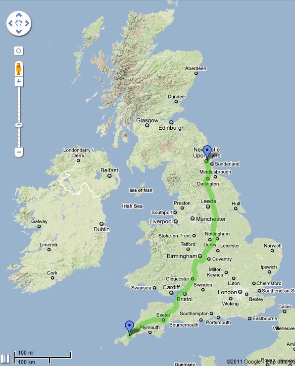
I wrote recently that Britain is one of the least-wooded countries in Europe (read more) with just 12% woodland cover, while England has even less at 9%. It is not well-known that the majority of woodlands in England are potentially moribund.
Of the 914,000 hectares of privately-owned woodland in England 265,000 hectares receives Forestry Commission-approved management grants. This leaves 649,000 hectares, or 71% of private woodland without an approved management plan[1]. This is currently the best available estimate of under-managed woodlands although it is important to note that the lack of an approved Forestry Commission plan does not necessarily equate to an unmanaged status.
However, it provides a worrying insight to the big picture regarding the state of forests in the UK. In essence there is a relatively low amount of woodland cover in Britain and much of it could be in poor condition. This is why 13 leading environmental organisations recently called for more woodland management, to halt the decline in woodland biodiversity (see Wildlife Link statement). This lack of management also undermines attempts to create a woodland resource that is economically and environmentally resilient. This is the core of the work of the Sylva Foundation (my day job).
649,000 hectares – how much is that exactly? For a start, it equals 5% of the entire land area of England. Or to put it another way, if these woodlands were lined up together it is equivalent to a wall of woodland over 5 miles wide stretching 450 miles and the length of England: from Truro in Cornwall, to Newcastle-upon-Tyne in the north-east.
In case the maths is of interest, here goes:
- There are 100 hectares in one km2, so: 649,000 ha / 100 = 6,490 km2
- Truro to Newcastle is 724 km, so: 6,490 km2 / 724 km long = 8.96 km wide
- … or in miles: 450 miles long by 5.57 miles wide
Gabriel Hemery
[1] Pers. Comm. Head of Woodland Surveys, Forestry Commission. National Inventory of Woodlands and Trees – England.
 This work is licensed under a Creative Commons Attribution- NonCommercial- NoDerivs 3.0 United States License.
