In 1995 I took a series of panoramic photos and made sketches to explore how Paradise Wood, the new woodland that I was creating for the Northmoor Trust, would fit in the landscape of the future. I was developing Paradise Wood as a new woodland and a centre for forestry research. My vision was to plant miles of new hedgerows, and to sow a new wildflower meadow in which I would plant some oak trees to create pasture woodland.
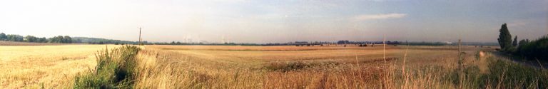
The view-point chosen was the south-east corner (OS Grid Reference SU562932), looking north-west across the large farmland site that was designated for the new woodland in southern Oxfordshire, England. You can see in the photograph above that the flat landscape was mostly featureless, with no hedgerows and few trees, and wall-to-wall with wheat. Look carefully at the righthand side of the photograph and you can spot the young large-leaved lime trees that had been recently planted alongside the road to create an avenue. These were the first trees I planted on the site, in winter 1992/93.
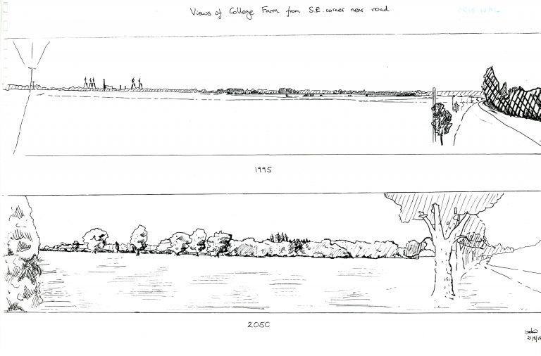
The sketches above depict the same view and were made in 1995. I also included a vision for how the same view might appear fifty five years later in 2050. Notice that I had illustrated the planting of the new hedge to the left (west).
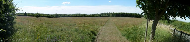
So, here is the view taken this year in July 2010. Although only 15 years later the transformation of the landscape is dramatic. The hedgerow on the left is looking mature. The wildflower meadow in the foreground is rich with colour and life, and a new footpath crosses the meadow towards the growing woodland. The lime avenue to the right is thriving. Also notice the feature oak trees starting to become prominent landscape features near the back of the meadow as a pasture woodland in the future. You can see an interesting aerial view of the meadow and woodland in Google Maps.
Gabriel Hemery
 This work is licensed under a Creative Commons Attribution- NonCommercial- NoDerivs 3.0 United States License.